Outdoor Exploration
Devil's Backbone & Bridge Site Walk
Walk the wooded Elk Creek crossing and the shale cliffs known as the Devil's Backbone, where the legends are set.
- Duration:
- 45 min
 Aerial survey · USDA NAIP · public domain
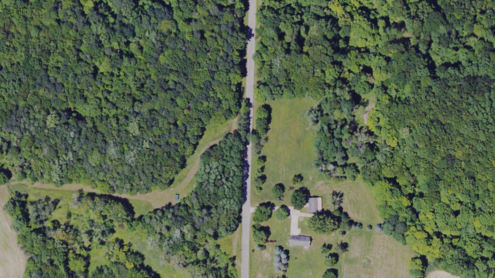
The wooded Elk Creek crossing in Girard Township where an 1868 covered bridge stood until arson destroyed it in 2008 — long famed for the ghost of a mule named Gudgeon and a girl who fell from the nearby Devil's Backbone cliffs.
Gudgeonville Road, Girard, PA 16417
Research updated May 2026
Age
All Ages
Cost
Free
Free; rural roadside site. The historic covered bridge no longer stands.
Access
Limited Access
Rural road over Elk Creek with steep shale cliffs (the Devil's Backbone) nearby; uneven footing.
Equipment
Photos OK
Est. 1868 · Historic 1868 covered bridge over Elk Creek, an Erie County landmark for 140 years · Destroyed by arson in November 2008 · Subject of one of northwestern Pennsylvania's best-known folk legends
The Gudgeonville Covered Bridge spanned Elk Creek in Girard Township, Erie County, in northwestern Pennsylvania. Built in 1868, the roughly 84-foot wooden covered bridge served the rural community along what is now Gudgeonville Road for 140 years.
The bridge's unusual name comes from a folk story dated to around 1855, before the bridge itself was built, when the spot was a small tavern stop. According to the most widely repeated version, a Kentucky drover named Obadiah Will was leading a mule named Gudgeon toward Meadville. As they reached the crossing, canal or river traffic nearby was playing 'My Old Kentucky Home.' In one telling the homesick mule dropped dead of fright; in another it froze and refused to move, and Will beat it to death in frustration. Either way, the animal was buried near the west bank and the name 'Gudgeonville' was painted on the bridge portals in its memory.
For generations the bridge was a beloved local landmark and a magnet for ghost-story seekers. On the night of November 8, 2008, the historic covered bridge was destroyed by fire, ruled an act of arson. The crossing itself, the creek, and the steep white shale cliffs nearby — known locally as the Devil's Backbone — still draw visitors, and the legends now attach to the land rather than the lost structure.
Sources
Two intertwined legends give the site its haunted reputation. The first is the mule of Gudgeon: locals say that on certain still nights you can hear the steady clop of hoofbeats and the braying of the homesick animal said to have died at the crossing around 1855, as recounted by regional storytellers and the Erie Reader's roundup of local ghost lore.
The second concerns a young girl said to have fallen to her death from the white shale cliffs called the Devil's Backbone, in accounts placing the event around the 1940s or 1950s. According to the tradition, an apparition of a pale figure in a dress appears at the top of the cliff, seems to fall, and disappears into the air. Other visitors have reported general feelings of presence and unease in the wooded ravine.
These stories are folklore passed down locally and through regional ghost-story collections rather than documented events; HauntBound presents them as the area's living oral tradition. With the bridge itself lost to arson in 2008, the legends now belong to the surviving creek crossing and cliffs.
Notable Entities
Walk the wooded Elk Creek crossing and the shale cliffs known as the Devil's Backbone, where the legends are set.
Every HauntBound history is researched from documented sources. We clearly separate verified historical fact from paranormal folklore.
Gatlinburg, TN
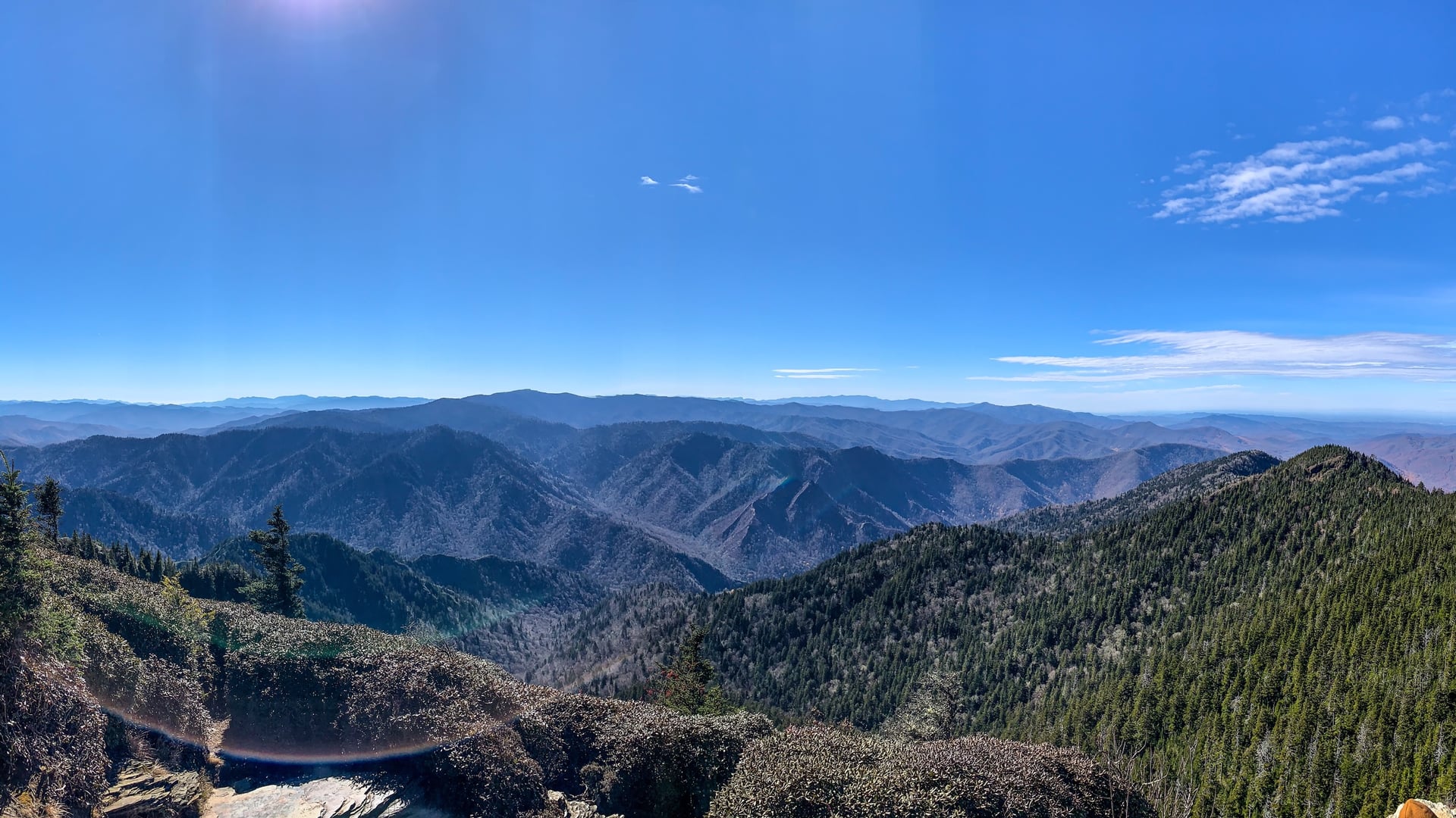
Great Smoky Mountains National Park preserves 522,427 acres of southern Appalachian terrain across Tennessee and North Carolina. The land was the heart of the Cherokee Nation before forced removal in 1838 along what became the Trail of Tears, and home to Appalachian Scots-Irish and English settler communities through the early twentieth century. Congress authorized the park in 1926; it was formally dedicated by Franklin D. Roosevelt on September 2, 1940.
Linville Falls, NC
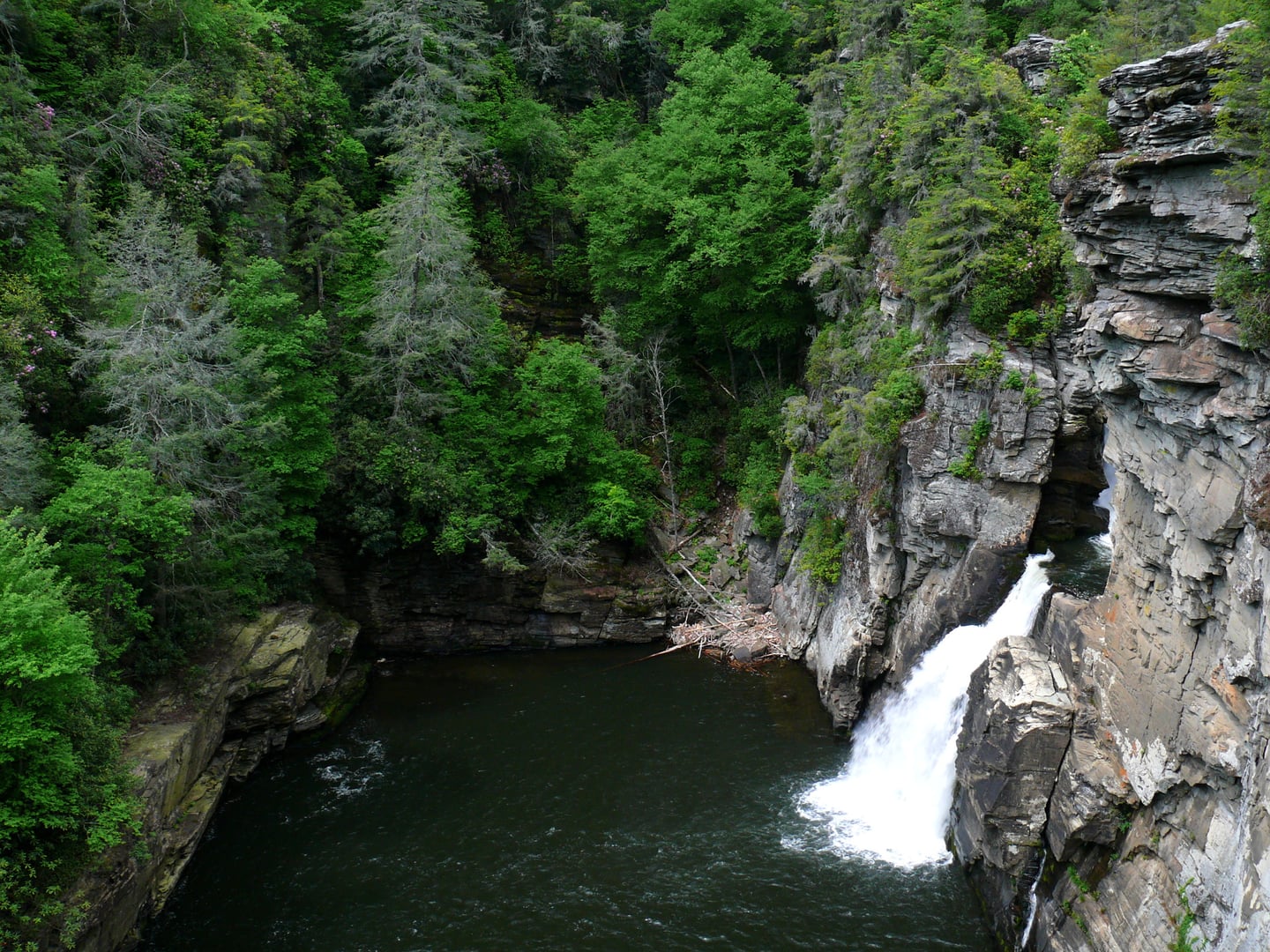
The Linville Gorge Wilderness in Burke County, North Carolina is part of the Pisgah National Forest and contains the deepest river gorge in the eastern United States. The Brown Mountain Lights — unexplained luminous phenomena visible from Wiseman's View and other overlooks near the gorge — were first reported in published accounts around 1910. A 1922 investigation by USGS scientist George R. Mansfield attempted to explain them as reflected headlights and brush fires but could not account for all reported sightings.

Marion, NC
Linville Gorge, carved by the Linville River through the southern Blue Ridge Mountains of Burke and McDowell Counties, is the deepest river gorge in the eastern United States. Managed as wilderness within Pisgah National Forest, the gorge has been associated with the Brown Mountain Lights phenomenon since at least 1910, when documented reports began appearing in print. USGS scientist George R. Mansfield conducted the first formal government investigation in 1922.