Est. 1918 · Eastern Kentucky Coal Mining History · Perry County Appalachian Heritage · Hardy-Burlingham Company History
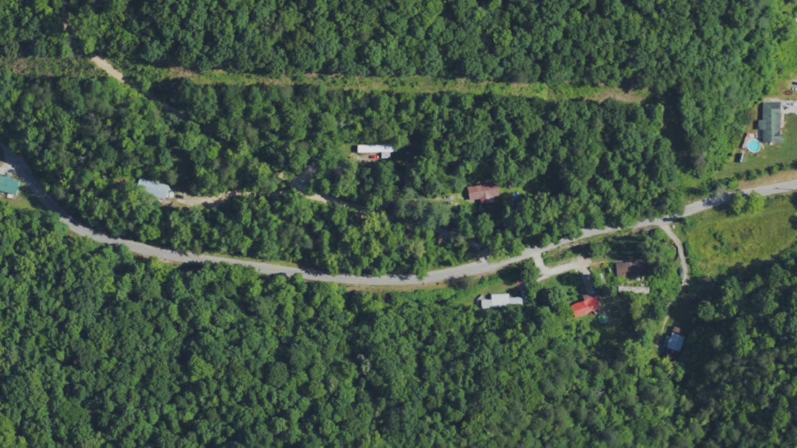
Hardburly sits in Perry County's rugged Appalachian terrain, a company-built coal camp that grew along the Jake Branch spur line in the early 20th century. The Hardy-Burlingham Mining Company established the camp around 1918 on what became one of the larger coal operations in the eastern Kentucky coalfields. A 1928 description credits the facility with a triple-tracked operation, one of the world's largest tipples, a workforce of up to 700 underground miners, and daily capacity of 4,000 tons.
Coal camp communities like Hardburly operated under company control — housing, stores, and community services provided by the mining operation. This created an intense, insular social environment tied directly to the economics and dangers of underground coal extraction. Floods were a recurring hazard in the creek-bottom communities of eastern Kentucky, where seasonal rainfall could transform Jakes Branch and similar waterways into lethal forces.
The Kentucky Coal Heritage program and the Appalachian Historian project have documented Hardburly's physical and social history. Photographs from the Hardy-Burlingham operation survive in the Digital Public Library of America. The town's peak was in the 1920s; like most eastern Kentucky coal camps, it declined as the industry mechanized and markets shifted.
Sources
- http://www.coaleducation.org/coalhistory/coaltowns/hardburly.htm
- https://appalachianhistorian.org/hardburly-perry-county-a-coal-camp-built-by-hardy-burlingham/
- https://www.kyatlas.com/ky-hardburly.html
Disembodied screamingPhantom soundsSensed presence
Coal Spring occupies a specific geography: the stretch of road that lines Jake Branch Stream through the Hardburly community. The setting — a creek-bottom road in a former coal camp, surrounded by steep hillsides, with no cell service — produces a particular quality of isolation that is both physical and acoustic.
The first account attached to the location is rooted in environmental tragedy. A boy drowned in flood waters along this stretch. The creek that runs through Hardburly is the same kind of waterway that has periodically flooded eastern Kentucky communities with devastating force. The report says he still screams there — his voice heard at the creek without a body to account for it.
The 1970s account is more behaviorally specific. A man running along the road became aware of something pursuing him. The unseen presence matched him step for step — when he accelerated, it accelerated; when he stopped to catch his breath, gasping, the sound of gasping echoed from just behind him. He climbed a bank. The sounds stopped. He continued on.
The mirroring behavior described in the 1970s account — a presence that replicates the physical state of a living person — is unusual in paranormal oral tradition. It suggests either an environmental acoustic phenomenon specific to the creek-bank terrain or a legend constructed to capture the particular anxiety of running through an unfamiliar dark landscape.
Notable Entities
The Drowned Boy