Bennington Triangle · Vermont Missing Persons History · Long Trail · Ghost Town
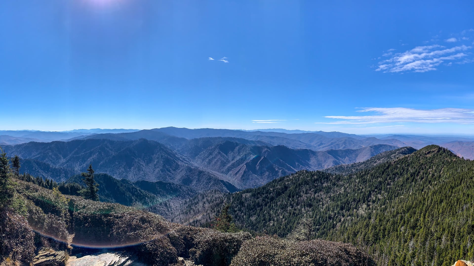
Glastenbury Mountain anchors approximately 36 square miles of wilderness in the southwestern corner of Vermont, encompassing the ghost town sites of Glastenbury and Fayville — communities that briefly existed around the logging and charcoal industries of the late 19th century and were abandoned after the railroad discontinued service to the area around 1900.
The mountain's modern reputation rests on five disappearances that occurred in a concentrated five-year period. Middie Rivers, a 74-year-old hunting and fishing guide thoroughly familiar with the terrain, vanished in November 1945 while leading a party back from Glastenbury Mountain. Paula Jean Welden, a Bennington College sophomore in a red jacket, was last seen walking the Long Trail near Route 9 in December 1946 — she appeared to a witness, walked around a bend, and was never seen again despite extensive searches. James Tedford, a 68-year-old World War I veteran, disappeared from a bus he had boarded in St. Albans, Vermont, in December 1949; witnesses saw him board, but he was not present when the bus arrived in Bennington. Eight-year-old Paul Jepson vanished from his mother's vehicle near a farm dump in 1950. Frieda Langer disappeared while hiking a familiar section of Glastenbury Mountain with her cousin that same year — she fell in a stream, left to change clothes, and never returned.
The disappearances drew national attention. Vermont, partly in response to the Welden case, established its first state police force. The cases remain officially unsolved.
Author Joseph Citro coined the term Bennington Triangle in 1992 to describe the geographic area encompassing the disappearances, a term that entered regional folklore. The mountain continues to draw researchers, hikers, and visitors interested in the historical record.
Sources
- https://en.wikipedia.org/wiki/Bennington_Triangle
- https://www.legendsofamerica.com/bennington-triangle-vermont/
- https://obscurevermont.com/the-vanished-town-of-glastenbury-and-the-bennington-triangle/
- https://www.vermontpublic.org/podcast/brave-little-state/2025-03-06/the-bennington-triangle-how-5-mysterious-disappearances-developed-a-cult-following-online
Residual hauntingShadow figures
Before the five disappearances gave the Bennington Triangle its modern contours, the mountain already carried older warnings. Algonquian-speaking peoples of the region used the mountain for burials and avoided it otherwise. Their lore described a cursed stone somewhere in the heights, a formation capable of opening and consuming anyone unlucky enough to step on it. No version of this tradition pinpoints the stone's location.
The absence-of-sound phenomenon recurs in visitor accounts without apparent coordination between witnesses. People entering the upper forest report that it goes quiet — not the quiet of a calm day, but the categorical absence of bird calls, insect noise, and small-animal movement that characterizes healthy forest. The observation has been made enough times, and is specific enough, to appear consistently across independent sources.
Five people vanished here between 1945 and 1950. Frieda Langer, whose body was eventually recovered in May 1951 in an area that had been thoroughly searched the previous fall, is the only one of the five whose fate was partially resolved. The others left no physical trace. The mountain did not reveal them.
The trails maintained by the Green Mountain Club stop well below the summit. Above that, the forest service roads — which appear as lines on maps — function more as snowmobile tracks than walking paths. The upper mountain is legitimately remote. Whether that remoteness is simply terrain, or something that the terrain has always been, is a question the disappearances did not answer.
Media Appearances
- Bennington Triangle — Vermont Public Radio Brave Little State (2025)