Self-Guided Visit
Fort and Grounds Tour
Tour the reconstructed Revolutionary War fort and walk the approach road and surrounding fields where local lore places a shadowy sentry and the orbs said to be children.
- Duration:
- 1.5 hr
HauntBound archive · catalog record
Reported phenomena, as catalogued
+ 1 further entry on record
A reconstructed 1778 Revolutionary War lead-mining fort in Sinking Valley, Blair County, where visitors report a shadowy sentry along the approach road and apparitions tied to the fort's original earthen footprint.
383 Fort Roberdeau Road, Altoona, PA 16601
Research updated June 2026
Age
All Ages
Cost
$
County-operated historic site; modest admission to the fort buildings, grounds and trails free during park hours.
Access
Limited Access
Rural valley site with grass, gravel and wooded trails
Equipment
Photos OK
Est. 1778 · Revolutionary War lead-mining defensive fort (1778) · Listed on the National Register of Historic Places (1974) · Reconstructed county historic site and natural area
Fort Roberdeau was erected in 1778 in Sinking Valley, in what is now Tyrone Township, Blair County, Pennsylvania. General Daniel Roberdeau, a Continental Congress delegate, built the stockade to protect lead miners and smelting operations whose output was critical to the Continental Army's ammunition supply during the Revolutionary War. The fort consisted of horizontal log walls with a bastion at each corner and was garrisoned until roughly 1780.
After the war the original fort fell into ruin and ultimately vanished from the landscape, leaving only its footprint in the surrounding farm fields. In 1974 the site was added to the National Register of Historic Places, and in the mid-1970s a full reconstruction was undertaken, rebuilt a short distance from the original location. The reconstructed complex includes officers' quarters, a storehouse, barracks, a blacksmith shop, a lead miner's cabin, a powder magazine and a lead smelter.
The 230-acre property is operated as a county historic site and natural area. In addition to the fort, it preserves a restored nineteenth-century barn that serves as a visitor center, a restored farmhouse, a sinkhole, and a trail system. Living-history events and educational programs interpret the fort's Revolutionary War role for visitors during the seasonal open period.
Because the reconstruction sits roughly a quarter mile from the original earthworks, local tradition holds that disturbing the original ground is the source of the site's reported hauntings, which cluster along the entrance road and the adjacent fields rather than at the rebuilt fort itself.
Sources
According to folklore documented in regional haunted-Pennsylvania compilations and the Shadowlands index, the hauntings at Fort Roberdeau are tied not to the reconstructed fort but to the field marking the original 1778 footprint, which lies roughly a quarter mile down the entrance road. Tradition says the relocation of the fort 'disturbed the ground' and stirred its restless spirits.
The most frequently repeated account describes a dark, shadow-like figure said to be a fort guard killed in an attack, seen pacing the entrance road near an old wooden utility pole after dark. Witnesses also describe two orbs, one light and one dark, drifting over the field, interpreted in the lore as the spirits of children, sometimes accompanied by the sound of a child's laughter and a dog barking.
Additional reports collected by visitors include sudden cold sensations, unexplained patches of fog, and odd noises along the public road that leads to the site. These tales are recounted as enduring local ghost lore rather than verified events, and the daytime historic site itself is presented as a family-friendly educational destination.
Notable Entities
Tour the reconstructed Revolutionary War fort and walk the approach road and surrounding fields where local lore places a shadowy sentry and the orbs said to be children.
Some links on this page may earn HauntBound a small commission when you book, at no extra cost to you. Our editorial picks are independent. Full disclosure
Every HauntBound history is researched from documented sources. We clearly separate verified historical fact from paranormal folklore.
Free Guide
11 verified stops, rated for families, mapped in order. Free.
One email to confirm, then the guide link. Unsubscribe anytime.
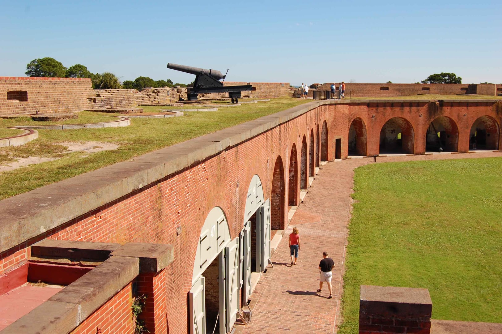
Savannah, GA
Fort Pulaski is a brick coastal fort on Cockspur Island at the mouth of the Savannah River, constructed between 1829 and 1847. The April 1862 Union bombardment with new rifled cannon breached the fort's masonry walls in 30 hours, demonstrating that masonry forts had become obsolete. In late 1864 the fort held the Immortal Six Hundred, Confederate officers held in retaliation; thirteen died on the island.
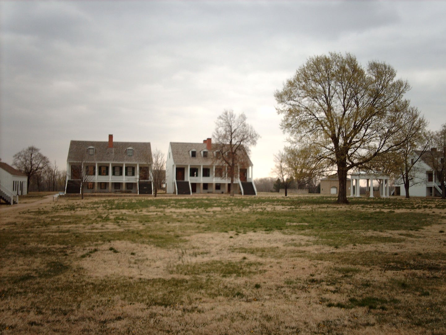
Fort Scott, KS
Fort Scott National Historic Site preserves a restored 1840s U.S. Army frontier post that served sequentially as a peacekeeping outpost on the Permanent Indian Frontier, a Bleeding Kansas border garrison, a Civil War supply depot, and a federal court venue. The site was designated a National Historic Site in 1965 and is operated by the National Park Service.
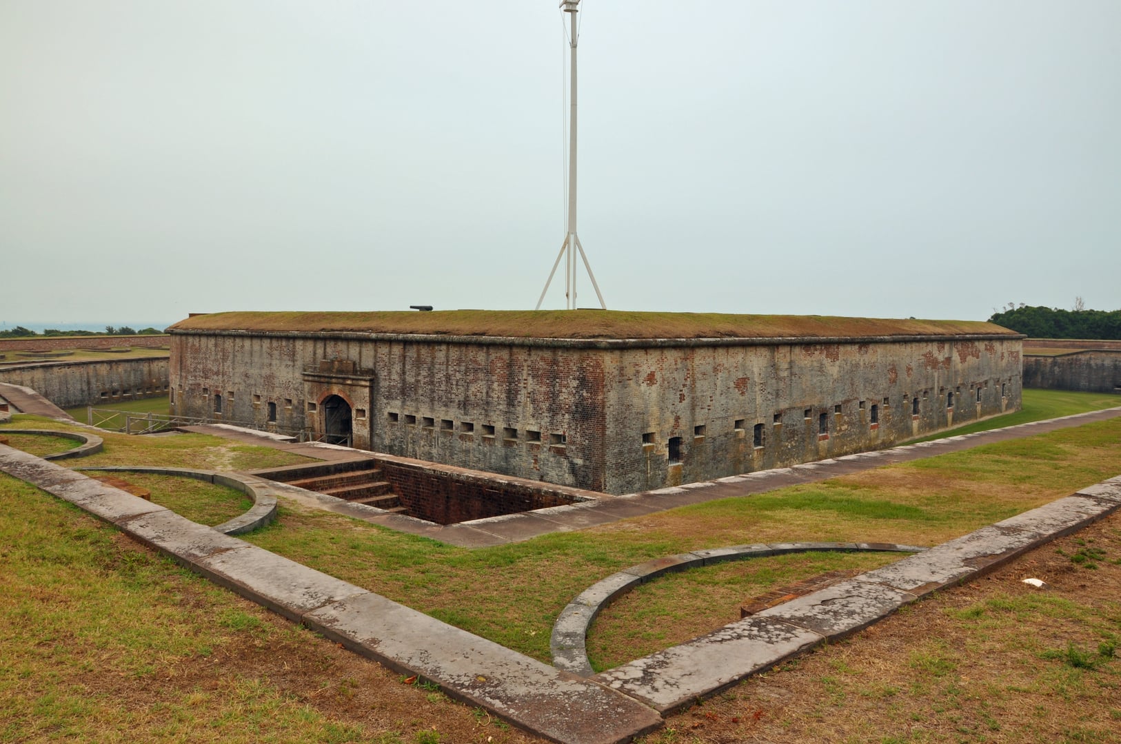
Atlantic Beach, NC
Fort Macon is a Third System brick coastal fort built between 1826 and 1834 to guard Beaufort Inlet on the North Carolina coast, named for U.S. Senator Nathaniel Macon. North Carolina militia seized the fort for the Confederacy in April 1861, and Union forces under Major General Ambrose E. Burnside recaptured it in 1862. It is now the centerpiece of Fort Macon State Park.