Est. 1873 · Established 1873 as one of the highest-elevation mining towns in Colorado · 23-day blizzard in 1884 deposited 25 feet of snow; multiple residents died · 1891 kitchen fire destroyed 14 buildings · BLM-managed historic site on the Alpine Loop 4WD byway
Animas Forks sits at the confluence of the Animas River's two source forks at 11,200 feet elevation, roughly 12 miles north of Silverton via County Road 2. The town was established in 1873 to serve the silver and gold mines operating in the surrounding peaks. At its peak, Animas Forks supported several hundred residents, a post office, a hotel, and a small commercial district.
In the winter of 1884, a blizzard lasting 23 consecutive days deposited 25 feet of snow on the townsite. The event was severe enough to be cited in regional disaster accounts; the mining infrastructure that survived was a function of the buildings' construction quality rather than any protective feature of the site. Several residents died attempting to travel during the storm. The town recovered enough to continue operating through the next decade, but a kitchen fire in 1891 destroyed 14 buildings, roughly half the remaining structures.
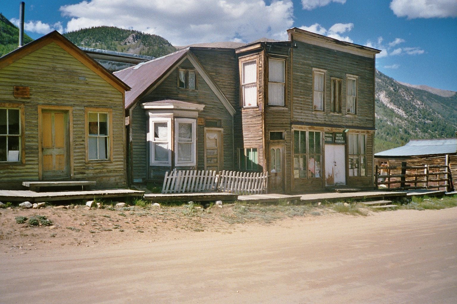
By the early 20th century, declining ore grades and the logistical difficulties of operating at this elevation had pushed most permanent residents to lower towns. The last residents left by the 1920s. The Bureau of Land Management now manages Animas Forks as a historic site on the Alpine Loop, a 4WD scenic byway connecting Silverton, Lake City, and Ouray. The William Duncan House, with its distinctive second-floor bay window, is among the best-preserved structures and a frequently photographed landmark.
Sources
- https://www.blm.gov/visit/animas-forks
- https://www.uncovercolorado.com/ghost-towns/animas-forks/
- https://www.durango.com/animas-forks/
Sense of being watched from mine and mill structuresAtmospheric oppressiveness not fully explained by altitudeUnexplained sounds and temperature drops among preserved structures
The paranormal accounts from Animas Forks are less specific than those from interior buildings, which is characteristic of high-altitude outdoor ghost towns where the dominant environmental features — wind, isolation, altitude, and silence — shape the experience. Visitors describe a sense of being watched from the mine structures and an oppressiveness not fully explained by altitude adjustment.
The 1884 blizzard, in which residents died attempting to travel and the town was buried under 25 feet of snow for more than three weeks, is the most frequently cited source of the site's dark character. The scale of the disaster at this specific location gives the paranormal accounts an anchoring in documented tragedy rather than vague frontier history.
The total absence of cell service and the significant drive time from the nearest town (12 miles on unpaved 4WD road) mean that visitors to Animas Forks are genuinely isolated. Reports of unexplained sounds, shadowy movement among the structures, and sudden drops in temperature occur in this context — making it difficult to separate environmental factors from accounts that visitors categorize as paranormal.