California Urban Legend · Vanishing Hitchhiker Folklore · Bay Area Highway History
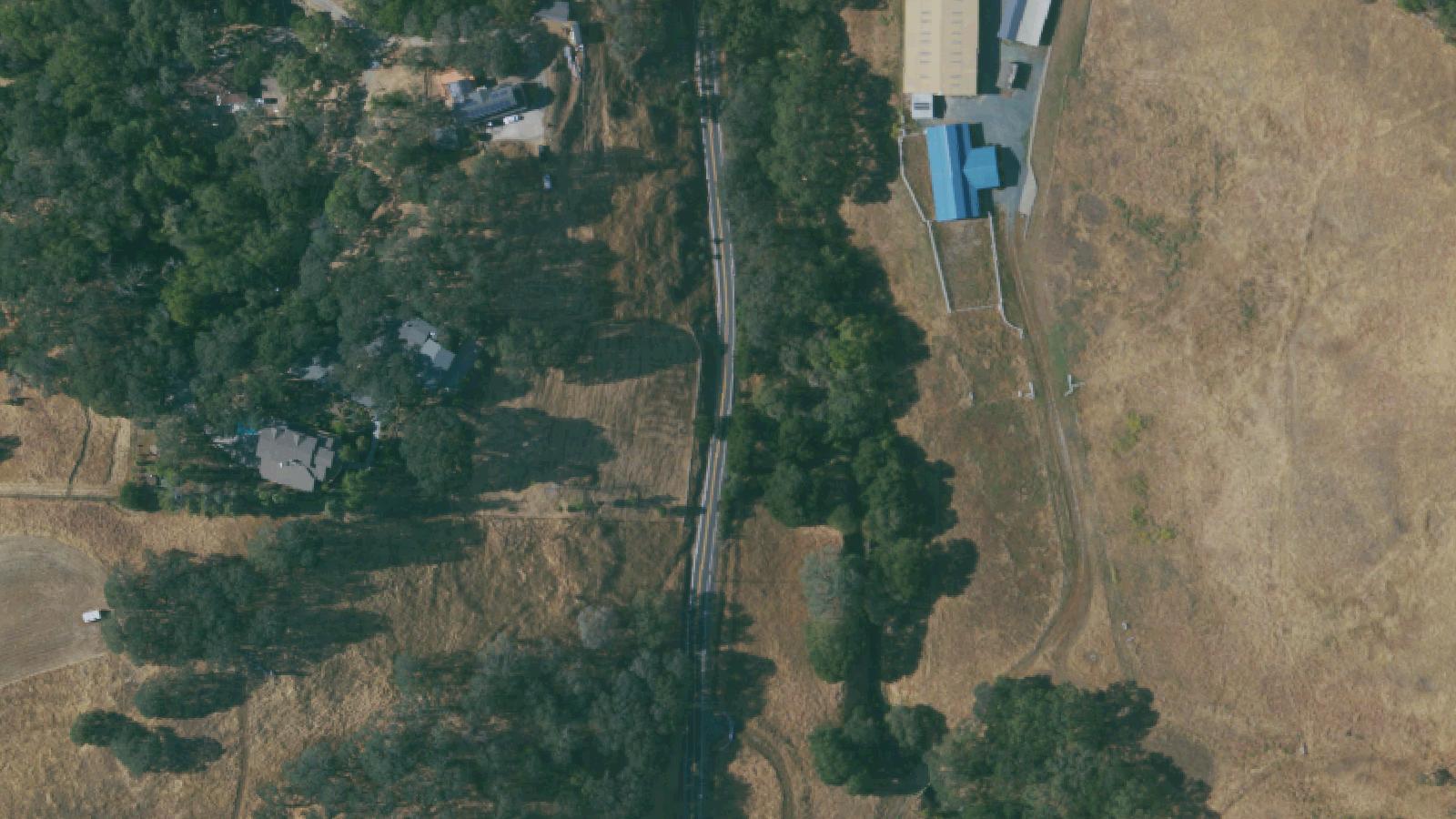
Niles Canyon Road follows Alameda Creek through a steep, winding seven-mile cut in the East Bay Coast Range, connecting the Niles District of Fremont with Sunol in southern Alameda County. The route was a major rail corridor in the late nineteenth century and remains an active two-lane state highway today.
The canyon has a documented record of fatal automobile crashes dating to the early years of motoring. A 1947 issue of the Oakland Post Enquirer described one section of the road as 'a traffic hazard and death trap.' The combination of tight curves, limited shoulder, and after-dark visibility has produced fatalities consistently across the past century.
The Niles Canyon Ghost folklore originated in the 1920s or 1930s, often dated to a February 28 fatal accident attributed to a young woman of the surname Lowerey, said to have been killed when her horse-drawn carriage was struck by an early automobile. Subsequent investigation by paranormal researchers and journalists, summarized in the Wikipedia entry and in J'aime Rubio's 'Dreaming Casually' investigative blog post, found no contemporary newspaper, county coroner, or church record of the named accident. The earliest documented Niles Canyon ghost story appeared in the 1930s and has been repeated continuously since.
The Niles District itself has a parallel and separate documented history as the location of Essanay Studios' West Coast operation, where Charlie Chaplin filmed The Tramp in 1915. The Niles Essanay Silent Film Museum maintains this aspect of the district's heritage.
Sources
- https://en.wikipedia.org/wiki/Niles_Canyon_ghost
- https://www.kqed.org/arts/13982493/niles-canyon-haunted-white-witch-deadly-crashes-tragic-bizarre-history
- https://epitaphpod.com/2019/the-white-witch-of-niles-canyon-road/
- https://dreamingcasuallypoetry.blogspot.com/2015/10/a-possible-mystery-solved-in-niles.html
- https://sfghosts.com/the-spirits-of-niles-canyon/
ApparitionsResidual haunting
The Niles Canyon Ghost is documented in California folklore studies and the Wikipedia entry on the vanishing-hitchhiker urban-legend cycle as a regional variant of one of the world's most-traveled ghost-story archetypes. The recurring elements: a young woman in a long white dress; an appearance in the back seat of a moving vehicle, typically late at night on February 28; conversation that turns sad as the driver approaches the Dumbarton Bridge area; and the figure's disappearance from the vehicle without explanation. The KQED Arts feature traces the legend's appearance in regional newspapers from the 1930s forward.
A distinct prank-history layer documents an early-1950s incident in which a young man in a white sheet jumped in front of motorists on a Niles Canyon bridge on Halloween. Police responded in force, with weapons drawn, on the assumption the figure was the White Witch. The prankster reportedly required hours at a coffee shop to recover his composure. This incident appears in regional press coverage and in the SF Ghosts and Epitaph podcast summaries.
Investigators consistently note that no contemporary county coroner record or newspaper account exists for the named Lowerey accident in either the carriage-versus-automobile or the spin-out-and-crash framing. The figure has nonetheless been seen and reported by multiple drivers across nearly a century, in accounts collected by paranormal researchers and regional historians.
The folklore overlaps geographically with the Mission San Jose church and cemetery in nearby Fremont, where photographs reported as showing orbs have been collected by paranormal investigators. Hauntbound treats the Mission San Jose material as a separate site.
Notable Entities
The White Witch of Niles CanyonMiss LowereyThe Niles Canyon Ghost
Media Appearances
- KQED Arts feature
- Epitaph Podcast