Est. 1942 · One of Oregon's largest WWII military installations (57,159 acres, 40,000 personnel) · German and Italian POW detention site, 1944–1946 · NPS-recognized most intact WWII cantonment footprint in the United States · Oregon State University research forest history
The War Department selected a site north of Corvallis in Benton County for a large training installation in 1942. Construction proceeded rapidly; within six months the 57,159-acre Camp Adair — formally named for 1st Lieutenant Henry R. Adair, an Oregon-born cavalry officer killed at the Battle of Carrizal in 1916 — was operational, with capacity for an infantry division of approximately 40,000 soldiers. At full population it would have ranked as the second-largest city in Oregon.
The base included a hospital complex approximately three-quarters of a mile south of the main cantonment, with its own 400-building sector designed to serve wounded sailors and marines from Pacific theater operations. The main base hospital was enlarged to a 3,600-patient capacity during the Navy's management period.
From August 1944 to July 1946, Camp Adair served as a prisoner-of-war facility, holding German and Italian POWs. The prisoners — initially Italians, then Germans after March 1945 — were assigned to farm labor, harvesting hops, beans, cherries, and other crops in the Willamette Valley. German POW Willi Gross left firsthand accounts of working on nearby farms. The POW program was not well publicized, and most local residents were unaware of it.
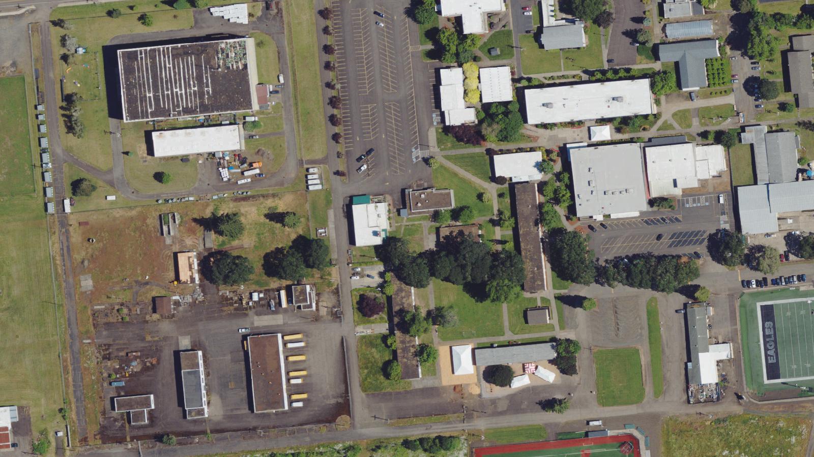
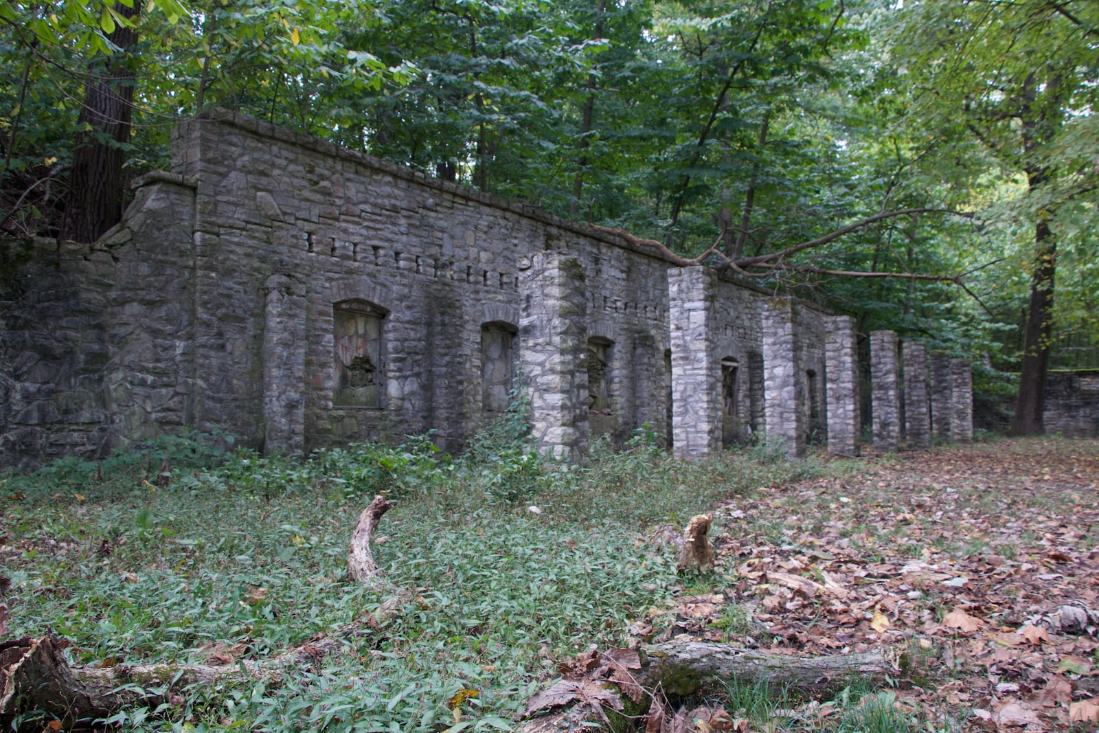
Following the war, Camp Adair was decommissioned. The vast majority of the cantonment's buildings were removed, leaving the street grid and concrete infrastructure as the primary landscape evidence. Beginning in 1946, some former hospital buildings served as faculty and student housing for Oregon State College (now Oregon State University). The National Park Service has characterized Camp Adair as 'the most intact example of the footprint of a U.S. Army World War II cantonment still in existence,' based on the survival of the complete street grid and at least five original WWII structures.
Adair Village was incorporated in 1976 around the surviving community core. The former mess hall, built in 1942, still stands and serves as a community center, neighbored by local schools.
Sources
- https://en.wikipedia.org/wiki/Camp_Adair
- https://en.wikipedia.org/wiki/Henry_R._Adair
- https://www.nps.gov/articles/000/preserving-the-historic-military-landscape-at-camp-adair.htm
- https://blogs.oregonstate.edu/scarc/2024/02/16/the-prisoners-of-war-who-werent-supposed-to-be-there-pows-in-camp-adair/
EVP recordingsPhantom footstepsSensed presence / being watched
The paranormal tradition at Camp Adair concentrates on the former hospital sector, approximately three-quarters of a mile south of the main cantonment area. Reports describe EVP recordings capturing the sound of squeaking bedsprings in rooms where no beds are present, footsteps in empty corridors, and an intense, persistent sense of being watched by unseen presences within the buildings.
This tradition has been independently documented by multiple Corvallis-area sources. The Corvallis Advocate, a local community newspaper, published an investigation of Corvallis hauntings in October 2014 that specifically named Camp Adair and described 'sounds such as squeaking bed springs and footsteps, as well as a sense of being menacingly observed by unseen eyes from within the building.' The Visit Corvallis tourism bureau has also independently noted the camp's haunted reputation, referencing 'the sensation of a menacing presence staring at you from darkened buildings.' Both sources are independent of the original Shadowlands submission.
Regional accounts describe the grounds as saturated in the sorrow and suffering of the German and Italian POWs who were held there, some of whom died before the war ended. The base's enormous wartime scale — a city of 40,000 people built and then abandoned within a decade — and the specific history of POW confinement lend the landscape atmospheric weight that has generated persistent paranormal interest.